

Historical disaster response frameworks operated on information cycles measured in hours, with situation reports compiled from fragmented ground observations reaching incident commanders at intervals too long to support the dynamic decision-making that fast-moving emergencies demand. The introduction of increasingly capable aerial surveillance assets compressed these information cycles progressively, but the endurance limitations of conventional aerial platforms meant that even the most sophisticated manned aircraft surveillance could only provide periodic updates rather than the continuous real-time intelligence picture that truly responsive disaster management requires. Aerostatic drone technology is delivering that continuous real-time picture in a way that is not an incremental improvement on what came before but a fundamental transformation of what real-time disaster management intelligence can mean when the platform providing it never leaves the operational area, never interrupts its sensor operations, and never creates the information gaps that conventional aerial assets generate whenever their operational cycles require them to depart for refuelling, recharging, or maintenance.
Redefining Real-Time in Disaster Operations
The concept of real-time intelligence in disaster management contexts requires careful definition because it is a standard whose practical meaning varies enormously depending on the platform architecture delivering the intelligence and the operational timescales within which the decisions it informs must be made. For a flood response commander deciding whether to commit rescue boats to a particular inundated district, real-time means knowing the current extent of inundation, the current condition of the access routes into that district, and the current positions of affected residents requiring rescue at the moment of decision, not the situation as it existed during the last aerial reconnaissance sortie conducted an hour ago when conditions may have changed significantly.
For a wildfire incident commander deciding where to position air tanker drops and ground crews, real-time means knowing where the fire front currently is, which direction it is currently moving, and where spotting ahead of the main front is currently occurring, with the continuous updates needed to adjust resource positioning as wind shifts and terrain-driven fire behaviour changes create new threat vectors that were not present when the last aerial observation was made. For an earthquake response commander directing search and rescue teams across a collapsed urban area, real-time means continuously updated information about which structures are still moving, where thermal signatures indicating trapped survivors have been detected, and which access routes into the affected area remain passable as aftershocks and secondary collapses alter the operational environment.
In each of these scenarios, the gap between real-time information and information that is even an hour old is the gap between decisions made on accurate situational understanding and decisions made on outdated assessments whose inaccuracy may not be apparent to the commander relying upon them. The aerostatic drone eliminates this gap across all of these disaster management contexts simultaneously by maintaining continuous sensor coverage of the operational area without the interruptions that conventional aerial platforms create, ensuring that the intelligence picture available to disaster response commanders is always current rather than accurate only at the moment of its last aerial observation.
The Technical Foundation of Continuous Real-Time Coverage
The technical foundation that enables aerostatic drone technology to deliver genuine continuous real-time coverage rather than the approximation of continuity that frequent conventional aerial sorties provide is the tethered power architecture that distinguishes the aerostatic platform from every battery-powered and fuel-dependent aerial system. By drawing power continuously from a ground station through a secure tether rather than carrying the energy reserves that limit conventional platforms to finite operational durations, the aerostatic drone sustains its sensor suite and communication systems in uninterrupted operation throughout its deployment period, which is determined by operational requirements and planned maintenance schedules rather than by the depletion of onboard energy reserves.
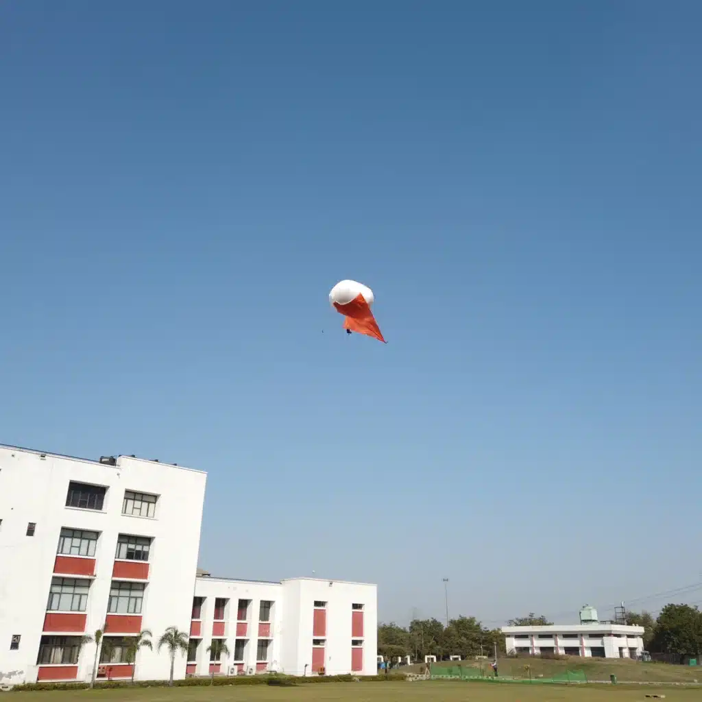
This continuous operational capability is what makes real-time disaster management intelligence from aerostatic platforms genuinely different in operational character from the intelligence provided by any conventional aerial asset regardless of how capable its sensors may be. The Atal DrishTI Tactical Aerostat demonstrates how this continuous real-time capability is realised in a platform specifically engineered for the operational demands of sustained deployment in the environmental conditions that disaster scenarios create, including the high winds, heavy rainfall, dust, smoke, and atmospheric variability that characterise the most severe emergency events. Its engineering ensures that sensor operations and data transmission quality are maintained through these conditions rather than degrading in the adverse circumstances where continuous real-time intelligence is most critically needed.
Flood Response Transformation Through Continuous Aerial Intelligence
The transformation of flood response capability through aerostatic drone technology begins at the moment of deployment and compounds in operational significance with every hour of continuous coverage the platform provides. In the first hours after a major flood event, when the extent of inundation is still expanding, when road conditions are changing rapidly as water advances across the transport network, and when the positions of residents requiring rescue are still being established, the continuous overhead view provided by an aerostatic drone allows incident commanders to build their operational picture in real time rather than assembling it retrospectively from the fragmented reports that ground teams submit when they are able rather than continuously as conditions demand.
The optical and thermal sensors of the aerostatic platform track flood water movement across the urban and rural landscape continuously, providing the dynamic inundation mapping that allows evacuation route guidance to be updated as routes become compromised and alternative corridors open or close in response to evolving flood conditions. Thermal imaging identifies the heat signatures of residents stranded in elevated positions within flooded structures, guiding rescue boat deployments toward the most critical locations and ensuring that survivors who cannot signal their positions through sound or movement are located and reached within the survival windows that exposure to flood conditions creates.
Communication relay functionality simultaneously restores the network connectivity that flood-induced infrastructure damage creates across affected areas, maintaining the multi-agency coordination that effective large-scale flood response requires through the elevated relay node the aerostatic platform provides above the flood plain regardless of the condition of ground communication infrastructure below.
Wildfire and Industrial Emergency Response
Wildfire management benefits from the aerostatic drone’s continuous real-time intelligence through the persistent thermal imaging that tracks fire behaviour through the smoke that conceals fire front advancement from optical sensors and ground observers. The continuous update rate of aerostatic thermal monitoring allows incident commanders to observe fire movement in real time rather than inferring it from the positions of the fire front at the times of successive aerial survey sorties, enabling the kind of anticipatory resource positioning that protects communities and firefighters more effectively than the reactive approaches that periodic aerial observation supports.
Industrial emergency response operations including major chemical plant incidents, refinery fires, and infrastructure failures involving hazardous materials benefit from the aerostatic drone’s persistent real-time monitoring capability combined with the safe standoff distance that the tethered platform’s stable elevated position provides, maintaining continuous coverage of hazardous operational areas without requiring response aircraft to operate in contaminated or otherwise dangerous airspace.
The Broader Aerial Innovation Ecosystem
The aerostatic drone technology revolutionising real-time disaster management belongs to the same broader aerial innovation ecosystem that drives creative and celebratory applications including drone show for event productions and drone show for wedding displays. The stable tethered flight architecture, multi-sensor payload integration, energy-efficient power management, and reliable real-time communication systems that define the operational excellence of disaster response aerostats share foundational engineering principles with the technologies that make spectacular aerial performances technically possible and operationally safe above the celebrations and public gatherings where they create their most powerful visual impact.
A drone show for event performance creating luminous choreographed formations above a national celebration or major public event, and a drone show for wedding display weaving coordinated aerial patterns above a family gathering, both reflect the maturation of the same aerial engineering disciplines that make the Atal DrishTI Tactical Aerostat operationally transformative in real-time disaster management contexts. The fail-safe flight systems, precise positional control, and reliable communication architectures that make a drone show for wedding both visually magnificent and operationally safe above its audience are expressions of the same technological rigour that sustains aerostatic disaster response platforms through continuous real-time deployment in the most demanding emergency environments India’s diverse geography and climate present.

© 2025 Crivva - Hosted by Airy Hosting Managed Website Hosting.