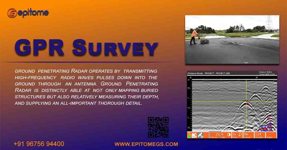
GPR Survey
Ground Penetrating Radar (GPR) surveys have emerged as the epitome of modern subsurface exploration, revolutionizing the way we unveil the hidden depths beneath our feet. This non-invasive geophysical method has become an indispensable tool in various fields, ranging from archaeology and environmental studies to civil engineering and utility mapping. In this blog, we will delve into the essence of GPR surveys, exploring their principles, applications, and the transformative impact they have had on our understanding of the subsurface.
Principles of GPR:
At its core, GPR operates on the principles of electromagnetic wave propagation. The system sends short pulses of high-frequency radio waves into the ground, and these waves penetrate the subsurface until they encounter a material boundary with different electrical properties. When the waves reflect back to the surface, GPR receivers capture the signals, providing information about the composition and structure of the subsurface materials.
Applications in Archaeology:
GPR has become a crucial tool in archaeological investigations, offering a non-destructive means to explore historical sites and uncover buried artifacts. Archaeologists use GPR to map subsurface features like walls, foundations, and even entire structures without disturbing the site. This technology has played a pivotal role in unraveling ancient mysteries and preserving cultural heritage.
Environmental Studies and Geology:
GPR is extensively employed in environmental studies and geology for mapping subsurface layers, detecting groundwater levels, and identifying potential contamination. Its high-resolution imaging capabilities allow researchers to analyze soil structures, delineate aquifers, and assess geological formations. This information is vital for environmental conservation efforts and sustainable resource management.
Civil Engineering and Infrastructure:
In civil engineering, GPR surveys have become indispensable for assessing the condition of infrastructure such as roads, bridges, and tunnels. By identifying subsurface anomalies, engineers can evaluate the integrity of structures and plan maintenance or repairs proactively. GPR also aids in utility mapping, helping to locate underground utilities and prevent accidental damage during construction projects.
Challenges and Innovations:
While GPR surveys offer a wealth of information, challenges such as signal attenuation in certain soil types and limited penetration depth in highly conductive materials have prompted ongoing research and innovations. Advanced signal processing techniques, multi-frequency systems, and the integration of GPR with other geophysical methods are some of the strategies employed to overcome these challenges, ensuring more accurate and comprehensive subsurface imaging.
Future Prospects:
The epitome of GPR surveys lies not only in their current applications but also in their potential for future advancements. As technology evolves, so too will the capabilities of GPR systems. Miniaturization, increased automation, and the integration of artificial intelligence are likely to play key roles in enhancing the efficiency and accuracy of GPR surveys, opening up new frontiers in subsurface exploration.
Conclusion:
Ground Penetrating Radar surveys have established themselves as the epitome of modern subsurface exploration, offering unparalleled insights across various disciplines. From archaeology to civil engineering, the transformative impact of GPR is evident in its ability to reveal the hidden complexities of the subsurface without disturbing the surface itself. As technology continues to evolve, GPR surveys are poised to remain at the forefront of non-invasive subsurface exploration, shaping our understanding of the world beneath our feet.
More info : https://epitomegs.com/our-services/ground-penetrating-radar-survey/
Contact : +91-96756 94400