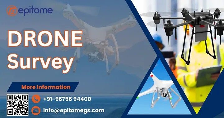
What is Drone Surveying?
Drone surveying utilizes unmanned aerial vehicles (UAVs) equipped with high-resolution cameras, LiDAR sensors, and other advanced equipment to capture aerial data. At Epitome Geo Technical Service, we leverage state-of-the-art drone technology to deliver cutting-edge survey solutions tailored to meet diverse needs.This method has emerged as a game-changer in the field of geospatial analysis, offering unparalleled accuracy, speed, and cost-effectiveness compared to traditional surveying methods.
Key Benefits of Drone Surveys:
Precision and Accuracy: High-resolution imagery and sensor data provide detailed insights with minimal error.
Efficiency: Drones can cover large and inaccessible areas in a fraction of the time it takes for traditional surveys.
Cost-Effective: Reduced manpower and quicker data collection translate to significant cost savings.
Safety: Eliminate the need for surveyors to navigate hazardous terrains or heights.
Versatility: Applicable across industries such as construction, agriculture, mining, and environmental studies.
Applications of Drone Surveying at Epitome Geo Technical Service
At Epitome Geo Technical Service, we specialize in providing tailored drone survey solutions across a wide range of applications:
1. Land Mapping and Topography
Our drones produce high-definition topographic maps and 3D models, enabling precise land analysis for construction, urban planning, and infrastructure projects.
2. Construction Site Monitoring
We assist in tracking project progress, identifying potential issues, and ensuring compliance with safety standards. Real-time data enables informed decision-making.
3. Environmental and Agricultural Surveys
From monitoring deforestation and water resources to assessing crop health, our drone surveys provide actionable insights to foster sustainability.
4. Mining and Quarrying
With drones, we offer volumetric calculations, pit analysis, and resource estimation, ensuring efficient operations and compliance with regulations.
5. Disaster Management
In times of natural calamities, drones play a crucial role in assessing damage, planning rescue operations, and aiding recovery efforts.
Why Choose Epitome Geo Technical Service?
At Epitome Geo Technical Service, we pride ourselves on being pioneers in integrating advanced drone technology into geotechnical solutions. Our team of experts combines technical expertise with innovative tools to deliver results that exceed expectations. Here’s what sets us apart:
Cutting-Edge Technology: We utilize the latest UAVs equipped with top-tier sensors and software for accurate data analysis.
Experienced Professionals: Our skilled team ensures seamless project execution from start to finish.
Customized Solutions: We tailor our services to meet the unique needs of each client.
Commitment to Excellence: Quality and client satisfaction are at the heart of everything we do.
Final Thoughts
Drone surveys are transforming the way we gather, analyze, and interpret spatial data. As a trusted partner in geotechnical services, Epitome Geo Technical Service is at the forefront of this transformation, delivering innovative and efficient solutions for a variety of industries.
More Info :https://epitomegs.com
Contact : +91-96756 94400
In the realm of modern technology, the sky is no longer the limit when it comes to capturing breathtaking views and gathering precise data. Epitome Noida, at the forefront of innovation, brings to the table an unparalleled blend of drone surveying and aerial photography services, revolutionizing the way we perceive and interact with our surroundings.
Unveiling the Power of Drone Surveying
Drone surveying has emerged as a game-changer across various industries, offering a myriad of benefits that traditional methods simply can’t match. Epitome Noida harnesses the potential of drones to conduct efficient and accurate surveys for diverse purposes, from land mapping and construction site monitoring to environmental assessments and infrastructure inspection.
One of the key advantages of drone surveying lies in its ability to access remote or hazardous locations with ease, minimizing risks to human personnel while maximizing data collection capabilities. Equipped with high-resolution cameras, LiDAR sensors, and GPS technology, drones empower Epitome Noida to capture detailed imagery and generate precise 3D models and topographic maps, facilitating informed decision-making processes for clients across various sectors.
Aerial Photography: Capturing Beauty from Above
Beyond the realm of practicality, Epitome Noida’s aerial photography services offer a captivating glimpse into the world from a bird’s-eye view. Whether it’s capturing stunning landscapes, architectural marvels, or special events, our skilled team of photographers leverages state-of-the-art drones to transform ordinary scenes into extraordinary works of art.
From real estate marketing and tourism promotion to cinematography and environmental documentation, aerial photography opens up a realm of creative possibilities, allowing clients to showcase their projects and properties in an immersive and visually compelling manner. With Epitome Noida’s expertise in aerial imaging, every frame tells a story, evoking emotions and sparking curiosity like never before.
Epitome Noida: Where Innovation Soars
At Epitome Noida, excellence is not just a goal but a commitment woven into the fabric of our services. By integrating cutting-edge technology with a passion for precision and creativity, we redefine the standards of drone surveying and aerial photography, setting new benchmarks for quality, efficiency, and customer satisfaction.
Backed by a team of seasoned professionals and a fleet of advanced drones, Epitome Noida stands poised to meet the evolving needs of industries ranging from construction and agriculture to urban planning and entertainment. Whether it’s capturing panoramic vistas, conducting detailed inspections, or delivering actionable insights, we take pride in delivering results that exceed expectations and leave a lasting impression.
Elevate Your Perspective with Epitome Noida
In a world where innovation drives progress, Epitome Noida invites you to elevate your perspective and embrace the possibilities that lie beyond the horizon. Whether you’re seeking to optimize workflows, showcase your assets, or unlock new insights, our drone surveying and aerial photography services offer a gateway to a world of endless opportunities.
Experience the difference with Epitome Noida and embark on a journey where the sky is not the limit, but only the beginning. Contact us today to explore how our expertise can transform your vision into reality, one flight at a time.
More Info : https://epitomegs.com/our-services/gis-mapping/
Introduction:
Epitome Geotechnical is a Geographic Information System Mapping company in India. Drone surveys, once a futuristic concept, have now become an integral part of various industries. Our services are Drone Survey and Aerial Photography Survey Services in India.
The Epitome of Efficiency: The Benefits of Drone Surveys
Cost-Effective Solutions:
Traditional surveying methods often involve high costs, from labor to equipment. Drone surveys drastically reduce expenses by minimizing the need for extensive ground crews and reducing survey time. This affordability opens doors for smaller businesses and projects to access sophisticated surveying techniques.
Rapid Data Collection:
Drones equipped with advanced sensors and cameras can swiftly collect vast amounts of data in a short period. This not only accelerates the survey process but also allows for real-time data analysis, enabling quicker decision-making.
Enhanced Safety Measures:
Many surveying tasks, especially in industries like construction and mining, involve inherent risks. Drones eliminate the need for personnel to access hazardous areas, ensuring increased safety for workers. This benefit extends to the environment as well, as drones have a minimal impact compared to traditional surveying methods.
Precision and Accuracy:
The precision of drone surveying is unparalleled. High-resolution cameras and LiDAR sensors can capture details with an accuracy that surpasses traditional methods. This precision leads to more reliable data, contributing to better-informed decision-making.
Versatility Across Industries:
Drone surveys have found applications in various sectors, including agriculture, construction, environmental monitoring, and infrastructure development. Their adaptability makes them a versatile tool for professionals seeking efficient and reliable surveying solutions.
How to Take Flight: A Step-by-Step Guide to Starting Drone Surveys
Legal Compliance:
Before taking to the skies, it’s crucial to understand and adhere to the legal requirements for drone operation in your region. Obtain the necessary licenses and permissions to ensure compliance with aviation regulations.
Choose the Right Drone and Equipment:
Select a drone that suits the specific needs of your survey. Consider factors such as flight time, payload capacity, and the quality of onboard sensors. Investing in high-quality cameras and LiDAR systems enhances data accuracy.
Learn the Basics of Drone Operation:
Acquire the necessary skills to operate a drone safely and effectively. Familiarize yourself with flight controls, navigation systems, and emergency procedures. Many online platforms offer courses and certifications in drone operation.
Plan Your Surveys:
Before launching your drone, carefully plan the survey mission. Define the survey area, determine the required flight altitude, and establish the survey grid. Efficient planning ensures optimal data collection and processing.
Data Processing and Analysis:
After completing the survey, process the collected data using specialized software. This step involves creating detailed maps, 3D models, or other outputs depending on the survey’s purpose. Familiarize yourself with industry-standard software for accurate results.
Conclusion:
Drone surveys represent a technological epitome, revolutionizing the way we gather and analyze spatial data. The benefits they offer in terms of efficiency, cost-effectiveness, and safety make them an invaluable tool across various industries. By following the outlined steps, aspiring drone surveyors can embark on a journey that reaches new heights, both figuratively and literally. As the skies open up to these unmanned marvels, the future of surveying takes flight.
More Info : https://epitomegs.com/our-services/gis-mapping/
Contact : 91-96756 94400
Introduction:
In the ever-evolving landscape of technology, the utilization of drones has become increasingly prominent across various industries. One sector that has particularly benefited from this technological revolution is surveying. Drone surveys offer a range of advantages, from cost-effectiveness to increased efficiency, and Epitome Service in Noida stands at the forefront of this transformative wave.
The Rise of Drone Surveys:
Traditionally, land surveys were conducted through manual methods, involving labor-intensive processes and often leading to inaccuracies. The advent of drone technology has revolutionized this field, providing a faster, more accurate, and cost-effective alternative.
Drone surveys involve the use of Unmanned Aerial Vehicles (UAVs) equipped with advanced sensors and cameras. These devices capture high-resolution images and data, offering a comprehensive and detailed view of the surveyed area.
Advantages of Drone Surveys:
Speed and Efficiency:
Drone surveys significantly reduce the time required for data collection. Large areas can be covered in a fraction of the time compared to traditional methods.
Quick turnaround times enable businesses and organizations to make informed decisions promptly.
Cost-Effectiveness:
Manual surveys involve substantial manpower and resources. Drone surveys minimize human involvement, resulting in cost savings.
Reduced operational costs make drone surveys an attractive option for businesses looking to optimize their budget without compromising on data quality.
Precision and Accuracy:
Drones are equipped with advanced GPS technology, ensuring precise data collection.
High-resolution imaging allows for accurate mapping, helping to identify potential issues or opportunities with exceptional detail.
Epitome Service in Noida – Setting the Standard:
Epitome Service has emerged as a pioneer in providing cutting-edge drone survey solutions in Noida. Their commitment to excellence, coupled with state-of-the-art technology, has positioned them as a leader in the industry.
Comprehensive Survey Solutions:
Epitome Service offers a wide range of survey services, including land surveys, construction site assessments, and infrastructure inspections.
Their drone technology is adaptable to various industries, making them a versatile choice for businesses with diverse needs.
Professional Expertise:
The team at Epitome Service comprises skilled professionals with expertise in drone technology and surveying.
Their commitment to quality and precision ensures that clients receive accurate and reliable data for their projects.
Customized Solutions:
Epitome Service understands that each project is unique. They work closely with clients to tailor their services to specific requirements, ensuring optimal results.
Future Prospects:
As drone technology continues to advance, the future of surveying looks increasingly promising. Epitome Service in Noida is at the forefront of this technological shift, paving the way for more efficient, cost-effective, and accurate survey solutions.
In conclusion, drone surveys have become an epitome of modern surveying techniques, and Epitome Service in Noida stands as a testament to the transformative power of this technology. The marriage of expertise and innovation offered by Epitome Service makes them a reliable partner for businesses and organizations seeking to elevate their surveying capabilities in the digital age.
More Info :https://epitomegs.com/our-services/gis-mapping/
Contact :+91-96756 94400
#droneSurvey #Epitome #GeographicInformationSystemMappingservicesinIndia
Aerial Photography Survey
Epitome Geotechnical is a Geographic Information System Mapping company in India. Our services are Drone Survey and Aerial Photography Survey Services in India.
In the vast realm of photography, one niche has soared to new heights, quite literally – Aerial Photography Surveys. This remarkable technique has evolved into an epitome of modern exploration, providing a unique perspective that transcends traditional boundaries. Let’s delve into the world of Aerial Photography Surveys and uncover the captivating vistas it unveils.
Unveiling the Bird’s-Eye View:
Aerial photography surveys offer a bird’s-eye view of the world, transforming landscapes into mesmerizing tapestries of colors and patterns. This form of photography employs aircraft, drones, or satellites equipped with high-resolution cameras to capture images from elevated positions. The result is a breathtaking panorama that transcends the limitations of ground-based photography.
Revolutionizing Industries:
Beyond its aesthetic appeal, aerial photography surveys have become invaluable tools across various industries. In agriculture, these surveys provide farmers with crucial insights into crop health, irrigation, and pest control. Urban planners utilize aerial images to map and analyze city landscapes, aiding in efficient infrastructure development. In environmental studies, researchers monitor changes in ecosystems, deforestation, and climate impact.
Technological Marvels:
The advent of drone technology has played a pivotal role in the accessibility and popularity of aerial photography surveys. Drones offer a cost-effective and versatile solution, capable of reaching remote or hazardous locations without compromising safety. The ease of operation and advancements in camera stabilization technology contribute to the production of stunning, high-quality images.
Precision and Accuracy:
Aerial surveys are not just about capturing beautiful images; they are also instrumental in achieving precision and accuracy in various applications. Cartographers and geographers use these surveys to create detailed maps and topographic models. Construction professionals rely on aerial data for site planning, progress monitoring, and resource management. The level of detail obtained from these surveys is unparalleled, fostering a new era of meticulous analysis and decision-making.
Evolving Regulatory Landscape:
The rapid growth of aerial photography surveys has led to the evolution of regulatory frameworks to ensure responsible and safe usage. Governments and aviation authorities worldwide are adapting to the challenges posed by increased drone activity. Licensing requirements, no-fly zones, and privacy considerations are integral aspects of navigating the legal landscape surrounding aerial photography.
Artistic Expression Elevated:
While practical applications abound, aerial photography surveys also serve as a canvas for artistic expression. Photographers explore the interplay of light and shadow on vast landscapes, capturing ethereal moments that challenge our perception of the world. The fusion of technology and artistry in aerial photography opens up new realms of creative possibilities, fostering a dynamic intersection of science and aesthetics.
Conclusion:
In the rapidly evolving landscape of photography, aerial photography surveys stand out as a testament to human ingenuity and curiosity. From revolutionizing industries to offering a fresh perspective on the world, these surveys have become an epitome of modern exploration. As technology continues to advance, and regulations adapt, the future promises even more breathtaking vistas and invaluable insights courtesy of aerial photography surveys, elevating our understanding of the world around us to new heights.
More Info : https://epitomegs.com/our-services/gis-mapping/
Contact : +91-96756 94400