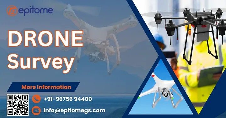
What is Drone Surveying?

Drone surveying utilizes unmanned aerial vehicles (UAVs) equipped with high-resolution cameras, LiDAR sensors, and other advanced equipment to capture aerial data. At Epitome Geo Technical Service, we leverage state-of-the-art drone technology to deliver cutting-edge survey solutions tailored to meet diverse needs.This method has emerged as a game-changer in the field of geospatial analysis, offering unparalleled accuracy, speed, and cost-effectiveness compared to traditional surveying methods.

Key Benefits of Drone Surveys:

Precision and Accuracy: High-resolution imagery and sensor data provide detailed insights with minimal error.

Efficiency: Drones can cover large and inaccessible areas in a fraction of the time it takes for traditional surveys.

Cost-Effective: Reduced manpower and quicker data collection translate to significant cost savings.

Safety: Eliminate the need for surveyors to navigate hazardous terrains or heights.

Versatility: Applicable across industries such as construction, agriculture, mining, and environmental studies.

Applications of Drone Surveying at Epitome Geo Technical Service

At Epitome Geo Technical Service, we specialize in providing tailored drone survey solutions across a wide range of applications:

1. Land Mapping and Topography

Our drones produce high-definition topographic maps and 3D models, enabling precise land analysis for construction, urban planning, and infrastructure projects.

2. Construction Site Monitoring

We assist in tracking project progress, identifying potential issues, and ensuring compliance with safety standards. Real-time data enables informed decision-making.

3. Environmental and Agricultural Surveys

From monitoring deforestation and water resources to assessing crop health, our drone surveys provide actionable insights to foster sustainability.

4. Mining and Quarrying

With drones, we offer volumetric calculations, pit analysis, and resource estimation, ensuring efficient operations and compliance with regulations.

5. Disaster Management

In times of natural calamities, drones play a crucial role in assessing damage, planning rescue operations, and aiding recovery efforts.

Why Choose Epitome Geo Technical Service?

At Epitome Geo Technical Service, we pride ourselves on being pioneers in integrating advanced drone technology into geotechnical solutions. Our team of experts combines technical expertise with innovative tools to deliver results that exceed expectations. Here’s what sets us apart:

Cutting-Edge Technology: We utilize the latest UAVs equipped with top-tier sensors and software for accurate data analysis.

Experienced Professionals: Our skilled team ensures seamless project execution from start to finish.

Customized Solutions: We tailor our services to meet the unique needs of each client.

Commitment to Excellence: Quality and client satisfaction are at the heart of everything we do.

Final Thoughts

Drone surveys are transforming the way we gather, analyze, and interpret spatial data. As a trusted partner in geotechnical services, Epitome Geo Technical Service is at the forefront of this transformation, delivering innovative and efficient solutions for a variety of industries.

More Info :https://epitomegs.com
Contact : +91-96756 94400


Introduction:

In the ever-evolving realm of surveying and mapping, the integration of cutting-edge technologies has become paramount. Aerial survey have a rich history, initially relying on manned aircraft to capture images from above. The advent of drones marked a significant shift, providing a more agile and cost-effective alternative. Among these advancements, aerial photography surveying stands out as a game-changer, providing unprecedented insights and data for various industries. In this blog, we delve into the world of aerial photography surveying, shedding light on the unparalleled advantages offered by EpitomeGS.

I. The Evolution of Surveying:

Traditional surveying methods, while effective, have their limitations. Aerial photography surveying emerged as a revolutionary approach, harnessing the power of unmanned aerial vehicles (UAVs) equipped with high-resolution cameras and state-of-the-art sensors. This shift has transformed the landscape of surveying, enabling professionals to collect accurate and comprehensive data in a fraction of the time it would take using conventional methods.

II. The EpitomeGS Difference:

EpitomeGS, a pioneer in aerial photography surveying, has elevated the industry standards by incorporating advanced technologies and a commitment to excellence. Here are some key aspects that set EpitomeGS apart:

1. Cutting-Edge UAV Technology:

EpitomeGS employs the latest UAV technology, ensuring a seamless and precise aerial surveying experience. These unmanned vehicles are equipped with high-resolution cameras, LiDAR systems, and other specialized sensors to capture detailed imagery and data from various altitudes.

2. Customized Solutions:

Recognizing the diverse needs of different industries, EpitomeGS offers tailored solutions to meet specific project requirements. Whether it’s land development, environmental monitoring, or infrastructure inspection, their team collaborates closely with clients to design a surveying plan that aligns with their objectives.

3. Rapid Data Acquisition:

Time is of the essence in many industries, and EpitomeGS understands the importance of swift data acquisition. Aerial photography surveying allows for rapid data collection over large areas, significantly reducing project timelines without compromising on accuracy.

4. High-Resolution Imaging:

EpitomeGS takes pride in delivering imagery of unparalleled quality. The high-resolution images captured during aerial surveys enable professionals to zoom in on intricate details, making it an invaluable resource for precise mapping, analysis, and decision-making.

5. Enhanced Safety Measures:

Safety is a top priority for EpitomeGS. By utilizing UAVs, they mitigate risks associated with traditional surveying methods, such as working at great heights or navigating challenging terrains. This not only enhances the safety of the surveying team but also reduces the impact on the environment.

III. Applications of Aerial Photography Surveying:

EpitomeGS’s aerial photography surveying services find applications across a spectrum of industries, including:

Construction and Development:

Monitoring construction progress, site analysis, and project planning.

Environmental Monitoring:

Assessing ecological changes, monitoring vegetation, and tracking environmental impact.

Infrastructure Inspection:

Inspecting bridges, pipelines, and power lines with precision.

Precision Agriculture:

Analyzing crop health, optimizing irrigation, and enhancing farm management.

Conclusion:

EpitomeGS has truly set a new standard in aerial photography surveying, leveraging cutting-edge technology to provide clients with unparalleled accuracy, efficiency, and safety. As industries continue to evolve, the EpitomeGS advantage remains clear – a commitment to excellence and a dedication to harnessing the power of aerial surveying for a brighter, more efficient future.

More Info : https://epitomegs.com/drone-aerial-photography-survey/
Contact : +91-96756 94400


Aerial Photography Survey

Epitome Geotechnical is a Geographic Information System Mapping company in India .In the dynamic realm of photography, the advent of aerial photography has marked a transformative epoch, providing a bird’s-eye view of our world and revolutionizing various industries. At the forefront of this aerial evolution is the Aerial Photography Survey, an epitome of precision and innovation that has reshaped the way we perceive and interact with our surroundings.

Unveiling the Aerial Advantage: Precision Redefined

Traditional ground-level photography, while invaluable, often falls short in capturing the grandeur and intricacies of landscapes, infrastructure, and environmental changes. Aerial photography, on the other hand, offers a unique vantage point that transcends these limitations, presenting a comprehensive and detailed perspective.

The precision achieved through aerial surveys is nothing short of remarkable. With advancements in drone technology and high-resolution cameras, surveyors can meticulously capture landscapes, construction sites, agricultural fields, and more with unparalleled detail. This precision is a game-changer for industries such as urban planning, agriculture, and environmental monitoring, where accuracy is paramount.

Applications Across Industries: Aerial Photography in Action

The applications of aerial photography surveys are as diverse as the landscapes they capture. In urban planning, aerial surveys provide planners with a holistic view of cityscapes, aiding in infrastructure development, traffic management, and disaster preparedness. The construction industry benefits immensely from real-time aerial monitoring of project sites, optimizing workflow and ensuring adherence to timelines.

In agriculture, the technology has proven instrumental in precision farming. Aerial surveys can assess crop health, identify areas of irrigation need, and even predict potential yield based on plant health indicators. This level of insight empowers farmers to make data-driven decisions, increasing efficiency and minimizing environmental impact.

Environmental monitoring and conservation efforts have also embraced aerial surveys. From tracking wildlife populations to monitoring deforestation, the ability to observe vast expanses from the air facilitates more effective conservation strategies. Aerial surveys contribute significantly to our understanding of ecosystems and aid in the preservation of biodiversity.

The Role of Technology: Drones as Pioneers

Central to the success of aerial photography surveys is the evolution of drone technology. Drones equipped with high-resolution cameras and advanced sensors can navigate even the most challenging terrains, capturing data from angles that were once inaccessible. This technological prowess not only enhances precision but also ensures the safety of surveyors by eliminating the need for risky manual inspections.

Moreover, the integration of artificial intelligence and machine learning algorithms in data analysis has expedited the processing of vast amounts of imagery. This not only saves time but also enhances the accuracy of the insights derived from aerial surveys.

The Future Soars Higher: Constant Innovation

As technology continues to advance, the future of aerial photography surveys holds exciting possibilities. From improved sensor capabilities to the integration of 3D mapping and virtual reality, the potential for innovation seems boundless. These advancements will not only refine the precision of surveys but also open new avenues for exploration and analysis.

Conclusion

The Aerial Photography Survey stands as the epitome of precision and innovation in the world of photography. Its transformative impact across various industries underscores its relevance and potential for shaping the future. As we continue to soar to new heights, both literally and metaphorically, through aerial surveys, the world below unfolds in unprecedented detail, revealing a tapestry of opportunities and insights waiting to be explored.

for more info :https://epitomegs.com/our-services/gis-mapping/
call us : +91-96756 94400


© 2024 Crivva - Business Promotion. All rights reserved.