Epitome offers advanced Drone Survey solutions for accurate, safe, and efficient infrastructure and project planning.
Noida, Uttar Pradesh – [Date] – Epitome Geotechnical Services, a leading provider of geotechnical and surveying solutions in India, is proud to announce the expansion of its services with state-of-the-art Drone Survey technology. As modern infrastructure projects demand precise data and efficient project monitoring, Epitome is empowering clients with high-accuracy aerial surveys that ensure faster decision-making, cost efficiency, and improved safety.
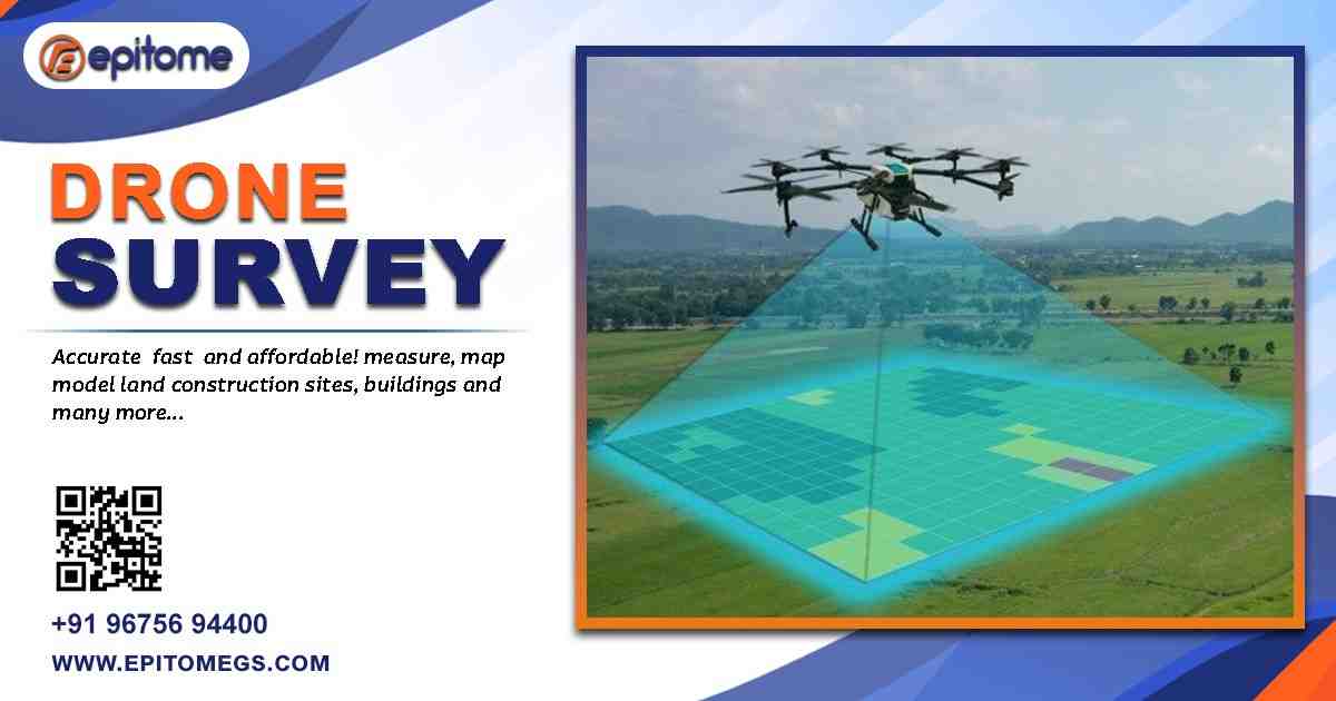
The surveying and mapping industry is experiencing a major technological shift, and drones are at the forefront of this transformation. Drone surveying, also known as UAV (Unmanned Aerial Vehicle) surveying, allows for high-resolution aerial data collection across large terrains with minimal human intervention. Unlike traditional survey methods, drone surveys provide faster, safer, and more accurate results, particularly in challenging or hazardous locations.
Epitome Geotechnical Services has embraced this innovation to deliver precision-driven solutions tailored for construction companies, infrastructure developers, urban planners, and environmental agencies. With cutting-edge drones equipped with LiDAR, photogrammetry cameras, and GPS integration, Epitome ensures that every survey captures accurate topographic data, volumetric measurements, and site conditions in real-time.
Drones are equipped with cutting-edge sensors such as high-resolution RGB cameras, LiDAR, multispectral imaging, and GPS systems for precise terrain mapping and 3D modeling. Data captured is seamlessly integrated with Geographic Information Systems (GIS) for enhanced visualization and analysis. Clients gain interactive maps, volumetric analyses, and detailed project insights, all accessible on user-friendly digital platforms.
Accuracy and Precision: Epitome’s drones capture high-resolution images and LiDAR data to produce accurate 3D models, contour maps, and orthophotos. This level of precision ensures that engineers and planners have reliable information for project design and implementation.
Time Efficiency: Traditional land surveys can take days or even weeks, especially for large or difficult terrains. Drone surveys reduce survey time drastically, enabling faster project timelines without compromising accuracy.
Cost-Effective Solutions: By minimizing manual labor and reducing on-site survey duration, Epitome’s drone survey services offer significant cost savings for clients while maintaining high-quality data standards.
Safety in Hazardous Conditions: Construction sites, uneven terrains, and inaccessible areas pose risks for survey teams. Drones can safely capture data in these conditions, reducing potential hazards for personnel.
Real-Time Data and Analysis: Epitome’s integrated software solutions allow clients to receive real-time data, digital maps, and analytical insights, improving decision-making and project planning.
Epitome’s drone survey services cater to a wide range of industries:
Construction and Infrastructure Development: From highways and bridges to commercial and residential projects, drones provide accurate topographical surveys, volumetric measurements, and progress monitoring.
Mining and Quarrying: Drone surveys allow mining companies to measure stockpiles, track excavation progress, and generate 3D models of sites efficiently.
Agriculture and Land Management: Drone surveys aid in mapping farmland, monitoring crop health, and analyzing irrigation patterns, enhancing precision agriculture practices.
Environmental and Urban Planning: Urban planners and environmental agencies benefit from high-resolution aerial imagery and topographic data to assess land use, monitor environmental changes, and plan sustainable development projects.
Epitome Geotechnical Services combines technical expertise with advanced drone technology to deliver comprehensive survey solutions. Their team of skilled surveyors and GIS specialists ensures every project meets stringent quality standards. The drones employed are equipped with advanced sensors, including high-resolution RGB cameras, LiDAR, multispectral imaging, and GPS systems, enabling detailed terrain analysis and 3D modeling.
In addition to capturing aerial imagery, Epitome integrates drone survey data with Geographic Information Systems (GIS) for actionable insights. This integration allows clients to visualize site layouts, monitor construction progress, and perform detailed volumetric and contour analyses, all through user-friendly digital platforms.
Epitome emphasizes a client-centric approach, tailoring survey solutions to meet specific project requirements. From initial site assessments to final data delivery, the company ensures transparent communication, timely updates, and actionable insights. Clients benefit from customized reports, interactive maps, and high-quality 3D models, empowering them to make informed decisions with confidence.
Epitome operates under strict safety protocols and complies with all UAV regulations mandated by the Directorate General of Civil Aviation (DGCA) in India. All drone pilots are certified professionals, ensuring safe operations even in complex urban and industrial environments. Safety remains a top priority alongside accuracy and efficiency.
Proven track record in geotechnical and surveying services across India
Advanced UAV technology with LiDAR, photogrammetry, and GPS integration
Experienced team of surveyors, GIS specialists, and drone operators
Customized solutions for construction, mining, agriculture, and urban planning
Timely data delivery and real-time analytics for project efficiency
CEO Statement
Speaking on the launch of Epitome’s advanced drone survey services, Mr. [CEO Name], CEO of Epitome Geotechnical Services, said:
“At Epitome, our mission is to leverage technology to deliver precise and reliable subsurface and aerial data for our clients. Drone surveying represents a major step forward in achieving faster, safer, and more cost-effective project outcomes. We are proud to offer this cutting-edge solution, ensuring our clients stay ahead in a competitive infrastructure and development landscape.”
As India’s infrastructure and urban development continue to expand, the demand for accurate, timely, and comprehensive survey data is increasing. Epitome Geotechnical Services plans to further enhance its drone survey capabilities, integrating AI-powered analytics, cloud-based data management, and enhanced real-time monitoring tools. This forward-looking approach ensures that clients can rely on Epitome for innovative solutions that meet the evolving needs of modern construction and development projects.
Founded with a commitment to precision and innovation, Epitome Geotechnical Services is a leading Soil Investigation Company and surveying solutions provider in India. The company specializes in a wide range of geotechnical services, including Ground Penetrating Radar Surveys, Underground Utility Surveys, Electrical Resistivity Imaging, and now advanced Drone Surveys. Epitome combines technical expertise, cutting-edge technology, and a client-centric approach to deliver reliable data that supports safe, efficient, and sustainable infrastructure development.
For more information on Epitome’s drone survey services or to request a consultation, please visit https://epitomegs.com
or contact:
📍 Address: 205, A74, A Block, Sector 63, Noida, Uttar Pradesh 201301
📞 Phone: +91-96756 94400
📧 Email: [email protected]