Drone Survey technology has transformed how land, construction, and infrastructure projects are planned and monitored.
At Epitome Geotechnical Services, we harness this cutting-edge technology to redefine mapping, monitoring, and project planning. Whether it’s large-scale land development, topographic mapping, or construction progress tracking, our Drone Survey services ensure unparalleled accuracy and operational efficiency.
In recent years, Drone Surveys have become one of the most valuable tools in geotechnical and infrastructure development. As industries demand faster, safer, and more accurate data collection, drones have stepped in as a game-changing solution. With advancements in aerial imaging, GPS technology, and data analytics, Drone Surveys are now an integral part of modern surveying methods.
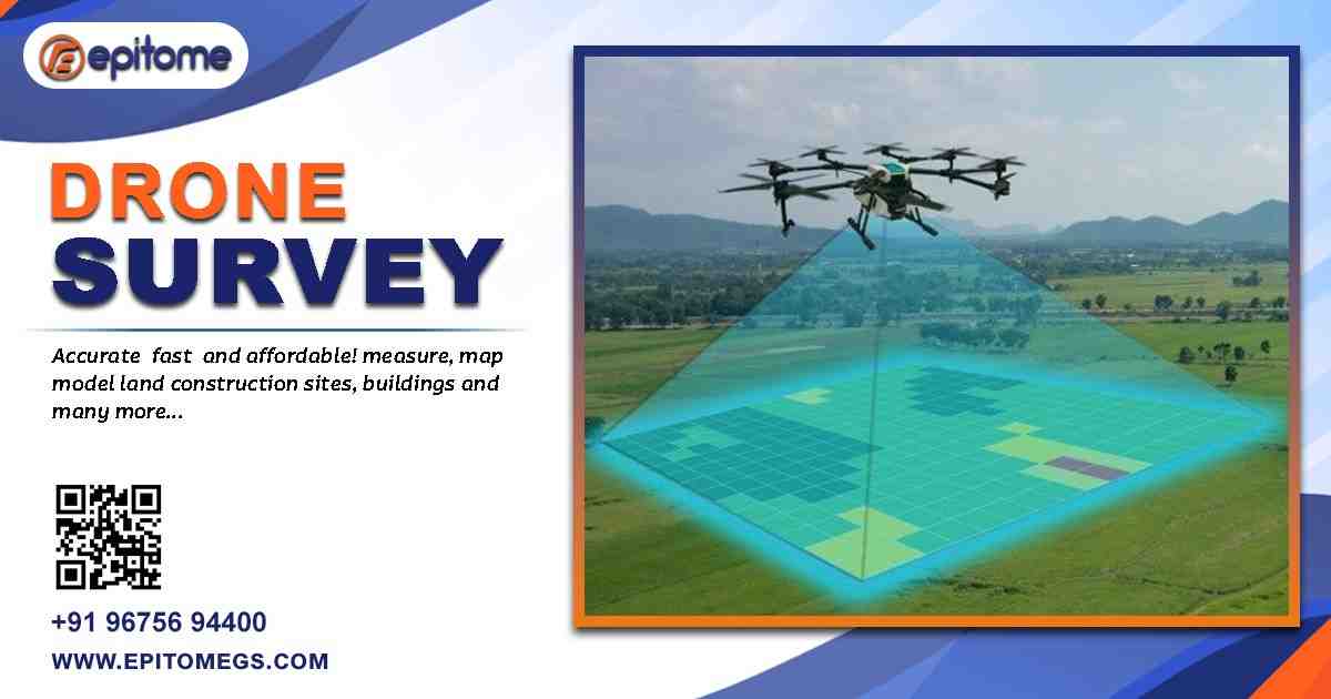
A Drone Survey involves the use of unmanned aerial vehicles (UAVs) equipped with high-resolution cameras, LiDAR, or photogrammetry sensors to capture aerial imagery and spatial data. These drones fly over a designated area, collecting detailed measurements that are later processed into accurate 2D maps, 3D models, or digital elevation models (DEMs).
Unlike traditional ground-based surveying, drones can cover vast areas in a fraction of the time, reducing fieldwork hours while improving precision. They’re particularly beneficial for challenging terrains, remote locations, and time-sensitive projects.
Drones equipped with advanced GPS and RTK (Real-Time Kinematic) systems provide centimeter-level accuracy. This ensures every contour, boundary, and feature is mapped with precision—ideal for geotechnical studies, design layouts, and earthwork calculations.
What might take weeks using conventional surveying methods can often be accomplished in just a few days with drones. This faster turnaround accelerates project timelines, saving both time and money.
A single drone flight can capture millions of data points, providing detailed imagery and surface data. This enables the creation of topographic maps, 3D models, and volumetric measurements with unmatched detail.
Reduced field time, minimal manpower, and rapid data acquisition make Drone Surveys a cost-effective solution, especially for large-scale projects like highways, industrial zones, or mining sites.
From land development and urban planning to agricultural management and infrastructure monitoring, Drone Surveys adapt to diverse project requirements.
At Epitome Geotechnical Services, we offer Drone Survey solutions tailored to meet industry-specific needs. Some of the key applications include:
Drones generate detailed topographic maps that accurately represent the terrain, elevations, and contours of a site. This data is invaluable for civil engineering designs, drainage planning, and earthwork estimation.
By capturing regular aerial imagery, drones provide real-time updates on project development. This helps project managers track progress, identify delays, and ensure work is proceeding as planned.
Drone Surveys help in calculating stockpile volumes, monitoring extraction activities, and ensuring safety compliance—all with high accuracy and reduced operational costs.
For highways, railways, and pipeline corridors, drones deliver precise corridor mapping, right-of-way assessments, and site inspection data essential for design and maintenance.
Urban planners rely on Drone Survey data for zoning analysis, land parceling, and environmental assessments. Aerial imagery helps visualize land use patterns and future development possibilities.
Drones equipped with multispectral cameras help in monitoring crop health, analyzing vegetation cover, and assessing environmental impact.
At Epitome, we follow a systematic approach to ensure the accuracy, efficiency, and reliability of every Drone Survey:
We begin by understanding your project requirements, objectives, and site conditions. This helps us plan the ideal flight paths, equipment, and sensors needed.
Using GPS-based flight control systems, we program drones to follow precise flight paths. High-resolution images and sensor data are collected in overlapping grids to ensure full coverage.
The raw data is processed using advanced photogrammetry software to generate orthomosaic maps, digital surface models (DSMs), and 3D reconstructions. Our experts verify every detail for accuracy.
Clients receive comprehensive survey reports, including georeferenced maps, CAD-compatible files, and visual data for easy integration with design and planning tools.
Expertise You Can Trust: Our team includes certified surveyors, GIS specialists, and drone pilots with years of field experience.
Cutting-Edge Technology: We use state-of-the-art UAVs and sensors for the highest data quality.
Customized Solutions: Every project is unique. We tailor our survey methods to your goals and site conditions.
Data Accuracy & Integrity: We adhere to strict quality control standards, ensuring data is precise, reliable, and compliant with industry norms.
Comprehensive Support: From initial consultation to final deliverables, Epitome provides end-to-end service and technical guidance.
As infrastructure and development projects grow more complex, Drone Survey technology will continue to evolve as a cornerstone of modern engineering. The integration of Artificial Intelligence (AI), machine learning, and cloud-based analytics will make drone data even more powerful and actionable.
At Epitome Geotechnical Services, we’re committed to staying ahead of the curve—leveraging emerging technologies to provide accurate, efficient, and sustainable surveying solutions. Our mission is to empower clients with data-driven insights that help build safer, smarter, and more resilient infrastructure.
The value of a Drone Survey extends beyond mapping and imagery—it lies in the power of actionable data. With every flight, Epitome’s drones capture thousands of high-resolution images and millions of data points that are transformed into precise analytics. This data allows engineers, architects, and planners to make confident, evidence-based decisions at every stage of a project.
Whether it’s calculating cut-and-fill volumes for earthwork, assessing slope stability, or identifying design constraints before construction begins, Drone Surveys help eliminate guesswork. The ability to visualize a project site from multiple angles also aids in detecting potential issues early, reducing costly rework and ensuring smooth execution.
Moreover, Drone Surveys foster better collaboration. When teams can view accurate 3D models, elevation profiles, and progress maps remotely, communication improves, and project transparency increases. This shared visibility ensures stakeholders stay aligned, leading to more efficient workflows and successful outcomes.
At Epitome Geotechnical Services, we combine aerial intelligence with geotechnical expertise, ensuring that every survey is not just a set of images—but a complete spatial solution designed to drive project success.
The Drone Survey has redefined how we view and measure the world around us. With its ability to capture high-resolution data quickly, safely, and cost-effectively, it’s no wonder that drones have become the preferred choice for modern survey projects.
By partnering with Epitome Geotechnical Services, you gain access to advanced aerial surveying solutions designed to deliver precision, clarity, and confidence in every decision you make.
📞 Phone: +91-96756 94400
📧 Email: [email protected]
🌐 Website: https://epitomegs.com/drone-aerial-photography-survey/