Epitome offers accurate Drone Survey solutions for safe, fast, and cost-effective project planning.
In today’s fast-paced construction, infrastructure, and environmental projects, accurate and timely data is critical for success. Traditional survey methods, while reliable, often require significant time, manpower, and resources — which can slow down projects and increase costs. This is where Drone Survey technology revolutionizes the way engineers, planners, and developers gather critical information.
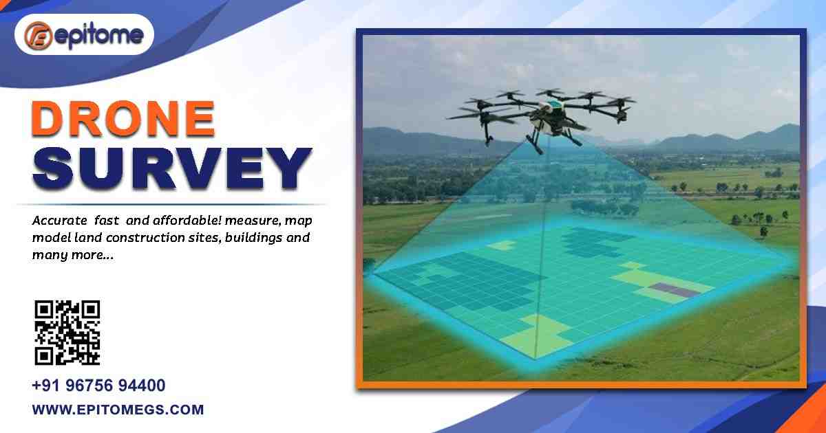
Epitome Geotechnical Services is at the forefront of this transformation, providing innovative Drone Survey solutions that combine advanced technology with industry expertise. With drones equipped with high-resolution cameras, LiDAR sensors, and GPS systems, Epitome captures precise aerial imagery and terrain data, allowing clients to make informed decisions efficiently and safely.
Drone surveys, also known as UAV (Unmanned Aerial Vehicle) surveys, have quickly become an essential tool in modern surveying. Unlike conventional methods, drones can cover large areas in a fraction of the time, accessing difficult terrains and hazardous locations without putting personnel at risk.
Precision and Accuracy: Drones capture detailed images and 3D models for topographical analysis, contour mapping, and volumetric calculations.
Time Efficiency: Large-scale surveys that once took days or weeks can now be completed within hours.
Cost Reduction: By minimizing manpower and equipment needs, drone surveys reduce overall project costs.
Safety: Drones eliminate the need for survey teams to work in unsafe or inaccessible areas.
Real-Time Data: Immediate access to survey data allows for quicker decision-making and improved project planning.
Epitome leverages these benefits to provide clients with accurate, actionable insights, enhancing both efficiency and safety on-site.
Epitome’s drone survey services cater to a wide range of industries:
Construction & Infrastructure: Monitor progress, map terrain, and manage resources efficiently. Drone surveys provide engineers with detailed data for site planning, excavation, and material management.
Urban Planning & Environmental Assessment: Evaluate land use, monitor environmental changes, and support sustainable urban development.
Mining & Quarrying: Measure stockpiles, track excavation volumes, and create 3D models of mining sites.
Agriculture & Land Management: Map farmland, assess crop health, and analyze irrigation patterns to optimize yields.
Disaster Management: Quickly survey areas affected by floods, landslides, or earthquakes to facilitate emergency response.
Renewable Energy Projects: Assess terrain for solar panels or wind turbines and monitor construction progress.
No matter the sector, Epitome’s Drone Survey solutions deliver accurate data, helping clients reduce risks, save time, and optimize project outcomes.
Epitome combines cutting-edge drone technology with the expertise of certified surveyors and GIS specialists. Drones equipped with high-resolution RGB cameras, LiDAR sensors, and GPS systems allow for precise mapping, 3D modeling, and volumetric measurements.
Data collected through drone surveys is seamlessly integrated with Geographic Information Systems (GIS), providing clients with interactive maps, volumetric analysis, and actionable insights. These advanced tools help clients visualize the terrain, monitor construction progress, and plan effectively for future development.
Epitome’s drone pilots are DGCA-certified and follow strict safety protocols to ensure both compliance and operational safety on every project.
Expertise in advanced surveying and geotechnical services
Cutting-edge UAV technology with LiDAR and photogrammetry
Certified team of drone operators and GIS specialists
Real-time data delivery for faster decision-making
Customized solutions for construction, mining, agriculture, and urban planning
Commitment to safety and regulatory compliance
Clients consistently praise Epitome for its precision, reliability, and ability to deliver actionable insights that support efficient, cost-effective project management.
Highway Construction: Epitome conducted a drone survey across a multi-kilometer highway project. The data helped engineers identify terrain variations, optimize cut-and-fill operations, and reduce project duration by several weeks.
Urban Development: For a densely populated urban project, Epitome’s drones provided accurate topographical mapping, enabling planners to design effective drainage systems, road networks, and green spaces without disturbing the surrounding environment.
Mining Operations: Drone surveys of a mining site helped track excavation progress, measure stockpiles, and generate 3D models, improving operational efficiency and safety.
These examples demonstrate the transformative impact of Drone Survey technology in modern project planning and execution.
Managing large construction projects requires accurate data for site planning, material management, and progress monitoring. Drone Survey technology allows project managers to capture high-resolution aerial images, track construction progress, and monitor resources in real-time.
Epitome integrates drone survey data with Geographic Information Systems (GIS) to provide clients with real-time insights. This allows teams to:
Access interactive maps and analytical dashboards
Monitor site changes instantly
Generate automated reports for stakeholders
Track project milestones and progress remotely
Real-time monitoring increases transparency, improves communication, and ensures projects remain on track.
With Epitome Geotechnical Services, construction teams can:
Detect deviations from project plans quickly
Monitor earthworks, cut-and-fill operations, and stockpiles
Reduce project delays by identifying issues early
Improve communication with stakeholders using 3D models and maps
This leads to more efficient decision-making, cost savings, and safer worksites.
Epitome is continuously innovating to enhance its drone survey capabilities. Future plans include AI-powered analytics, cloud-based data management, and real-time monitoring systems. By integrating these technologies, Epitome ensures that clients receive accurate, timely, and actionable data for smarter planning, safer operations, and sustainable development.
CEO Statement:
“At Epitome, our goal is to provide precision-driven solutions that empower our clients. Drone surveying allows us to deliver faster, safer, and more cost-effective results. We are committed to helping infrastructure and development projects succeed with accurate data and actionable insights.” – Mr. [CEO Name], CEO
Drone surveys are no longer a luxury—they are a necessity in modern infrastructure, construction, and environmental projects. Epitome Geotechnical Services leverages advanced UAV technology, expert teams, and innovative analytics to deliver precise, safe, and efficient survey solutions.With Epitome Geotechnical Services, clients gain access to high-precision drone surveys, 3D modeling, volumetric analysis, and GIS integration — all designed to deliver fast, safe, and cost-effective results.
Whether you are planning a large-scale construction project, managing agricultural land, or conducting environmental assessments, Epitome’s Drone Survey services provide the accuracy and insight you need to succeed.
Contact Epitome Geotechnical Services Today:
📍 205, A74, A Block, Sector 63, Noida, Uttar Pradesh 201301
📞 +91-96756 94400
📧 [email protected]
🌐 https://epitomegs.com